Geography and Tides
San Francisco Bay stretches approximately 60 miles (97 kilometers) from north to south, but it is surprisingly shallow — the average depth is only about 12 to 15 feet (3.7 to 4.6 meters). The bay is fed by freshwater from the Sacramento and San Joaquin Rivers, which flow in from the east through the Sacramento-San Joaquin Delta. This mixing of freshwater and saltwater from the Pacific Ocean creates what scientists call an estuary, a type of ecosystem that supports a wide variety of life. Twice each day, the tides push ocean water into the bay and pull it back out again. These tidal flows are so powerful at the Golden Gate that the water can move at speeds of up to 6 knots (about 7 miles per hour).
Wildlife
San Francisco Bay and its surrounding wetlands are a critical habitat for hundreds of species. The bay’s mudflats and marshes provide feeding grounds for more than one million migratory shorebirds and waterfowl each year, making it one of the most important stops on the Pacific Flyway, the migration route that stretches from Alaska to South America. Harbor seals haul out on rocks and sandbars around the bay, and bottlenose dolphins are occasionally spotted in its waters. The bay is also home to the Pacific herring, a small fish whose annual spawning season brings millions of fish into the shallow waters between December and March. Endangered species like the California clapper rail and the salt marsh harvest mouse depend on the bay’s remaining marshlands for survival.
Bridges and Transportation
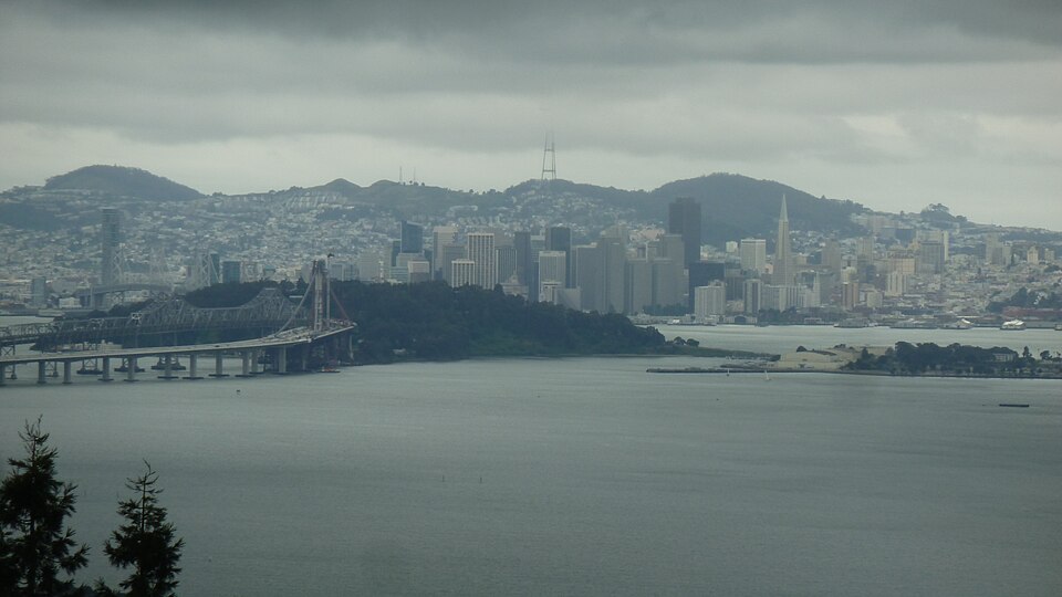
Two of the world’s most iconic bridges span San Francisco Bay. The Golden Gate Bridge, completed in 1937, crosses the Golden Gate strait and connects San Francisco to Marin County. Its distinctive International Orange color and Art Deco towers have made it one of the most photographed structures in the world. The San Francisco-Oakland Bay Bridge, commonly called the Bay Bridge, opened in 1936 and links San Francisco to Oakland across the central bay. At 4.5 miles (7.2 kilometers) long, it is one of the longest bridges in the United States. Ferry boats have also been an important form of transportation on the bay since the Gold Rush era, and today the San Francisco Bay Ferry system carries thousands of commuters across the water every day.
History
For thousands of years before European contact, the Ohlone and Miwok peoples lived along the shores of San Francisco Bay, fishing its waters and harvesting shellfish from its mudflats. In 1769, a Spanish scouting expedition led by Sergeant Jose Ortega became the first known Europeans to sight the bay. The Spanish established missions and presidios in the area during the late 1700s. The bay’s importance grew dramatically during the California Gold Rush of 1849, when San Francisco became the main port of entry for hundreds of thousands of people streaming into California. During World War II, the bay was a major military staging area, with shipyards in Richmond, Oakland, and other cities building and repairing warships and cargo vessels.
Environmental Challenges
San Francisco Bay faces several serious environmental threats. Over the past 200 years, approximately 85 percent of the bay’s original tidal marshes have been filled in or developed. This massive loss of wetlands has reduced habitat for wildlife and made shoreline communities more vulnerable to flooding. Industrial pollution, urban runoff, and treated sewage have introduced mercury, pesticides, and microplastics into the bay’s waters. Rising sea levels caused by climate change are expected to increase flooding risks for the low-lying areas around the bay. However, major restoration efforts are underway. The South Bay Salt Pond Restoration Project, one of the largest tidal wetland restoration projects in the western United States, is converting 15,100 acres of former salt evaporation ponds back into natural marsh and wildlife habitat.
Fun Facts
- The bay was formed about 10,000 years ago when rising sea levels at the end of the last Ice Age flooded a river valley.
- Alcatraz Island, the famous former prison, sits in the middle of San Francisco Bay.
- The Bay Area Rapid Transit (BART) system includes a 3.6-mile underwater tube that runs beneath the bay between San Francisco and Oakland.
- About 90 percent of California’s remaining coastal wetlands are found around San Francisco Bay.
- The bay is so shallow that if it were drained, you could walk across most of it!