How GPS Works
Each GPS satellite carries a very accurate atomic clock and constantly sends out radio signals that include the time and the satellite’s position. A GPS receiver on the ground, like the one in a smartphone, picks up signals from several satellites at once. By measuring how long each signal took to arrive, the receiver calculates how far away each satellite is. Using the distances from at least four satellites, the receiver figures out its exact latitude, longitude, and altitude through a process called trilateration. The whole calculation happens in a fraction of a second, so your location updates almost instantly.
A Brief History of Navigation
Before GPS, people used many different tools to find their way. Ancient sailors navigated by watching the stars, the Sun, and the Moon. In the 1100s, the magnetic compass was introduced to European sailors, helping them determine which direction was north even on cloudy days. Paper maps and sea charts became important tools for explorers during the Age of Exploration. In the 1900s, radio-based navigation systems helped ships and airplanes find their way, but these systems only worked in certain areas and were not very precise.
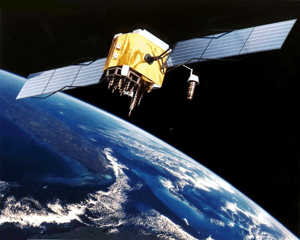
The GPS Satellite Constellation
The GPS satellites orbit about 20,200 kilometers above Earth and are arranged in six orbital planes so that coverage reaches every part of the planet. Each satellite circles Earth about twice per day, taking roughly 12 hours to complete one orbit. The satellites are powered by solar panels and carry backup batteries for when they pass through Earth’s shadow. Ground control stations around the world constantly monitor the satellites and send updates to keep their clocks and orbits accurate. When an older satellite wears out, a new one is launched to replace it so the system always has enough satellites working.
GPS in Everyday Life
GPS technology is part of many things you use or see every day. When your family uses a map app to get driving directions, GPS satellites are guiding the way. Delivery trucks and ride-sharing cars use GPS to find the fastest routes to their destinations. Many sports watches and fitness trackers use GPS to measure how far and how fast you run or bike. Even some pet collars have GPS trackers so owners can find a lost dog or cat. The game Pokemon Go uses GPS to place virtual creatures at real-world locations for players to find.
GPS for Safety and Emergencies
GPS plays an important role in keeping people safe. When someone calls 911 from a cell phone, the emergency dispatcher can use GPS to find out where the caller is located. Search and rescue teams use GPS to navigate through wilderness areas and find lost hikers. Airplanes depend on GPS to follow safe flight paths and land accurately at airports, even in fog or low visibility. Ships use GPS to avoid dangerous rocks and shallow waters. Many cars now have GPS-based systems that can automatically call for help if the vehicle is in a serious accident.
Other Navigation Satellite Systems
The United States built GPS, but other countries have created their own satellite navigation systems. Russia operates a system called GLONASS, which has about 24 satellites and works similarly to GPS. The European Union built Galileo, which began full service in 2016 and is designed to be even more accurate than GPS. China developed the BeiDou Navigation Satellite System, which achieved global coverage in 2020. Many modern smartphones and navigation devices can receive signals from more than one of these systems at the same time, which makes location tracking faster and more accurate.
The Future of Navigation
Scientists and engineers are always working to make GPS and navigation technology better. New GPS satellites being launched carry improved signals that are more accurate and harder to jam or interfere with. Researchers are developing systems that can pinpoint locations to within a few centimeters instead of a few meters. Self-driving cars will need extremely precise navigation to safely share roads with other vehicles and pedestrians. Indoor navigation is another growing field, since GPS signals are too weak to work inside large buildings like airports and shopping malls. The future of navigation will bring even smarter and more precise ways to find where we are and where we need to go.